
NASA Earth Thursday June 9, 2016
Coral Mission Starts Work in Hawaii
Even in dark glasses, Eric Hochberg is squinting a little in brilliant sunlight glinting from a green ocean. He is driving a research boat across Kaneohe Bay, Oahu, Hawaii, on June 7, the first day of the operations readiness test for NASA’s Coral Reef Airborne Laboratory (CORAL) mission. Hochberg, a scientist at the Bermuda Institute of Ocean Sciences and CORAL’s principal investigator, is overseeing tests of two instruments that measure water’s optical properties.
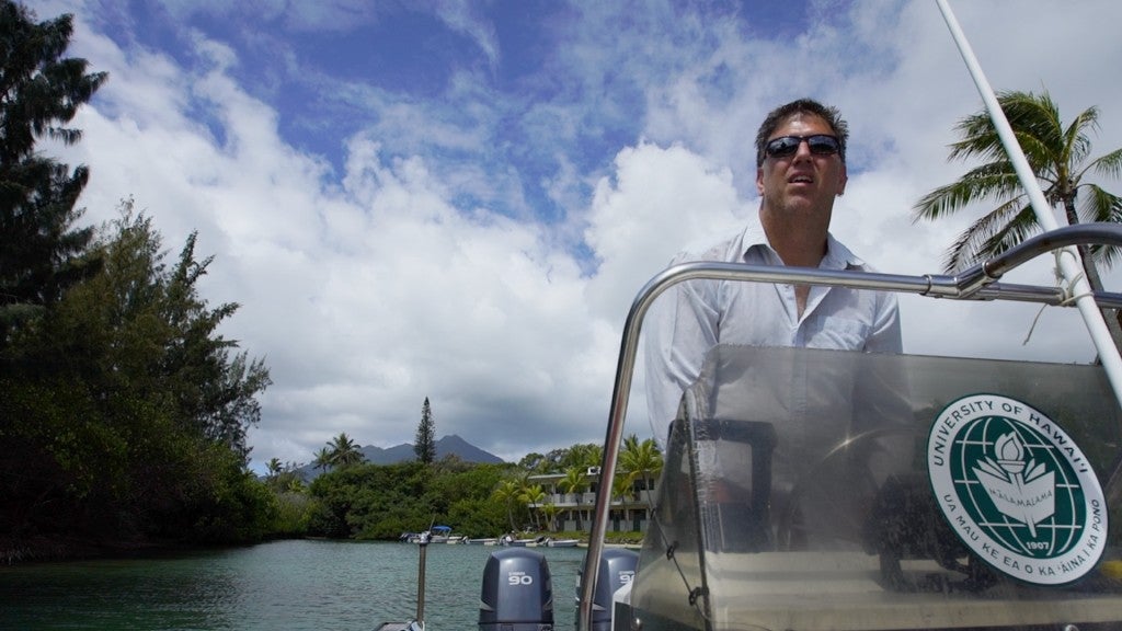
Eric Hochberg, principal investigator of the CORAL mission, steers the research boat in Kaneohe Bay. Credit: NASA/James Round
Kaneohe Bay is patchy in the sunlight, brighter and darker spots showing where the ocean floor is mostly sand and where there’s a coral reef. Warm, sheltered and spectacularly beautiful, the bay is a magnet for both locals and tourists. About a dozen tourist boats are moored on a large sandbar. Hochberg and his team appear to be the only people who are working anywhere in the vicinity, but in fact, a small island in the bay houses the researchers of the Hawaii Institute of Marine Biology (HIMB), CORAL’s base during this Hawaii test.
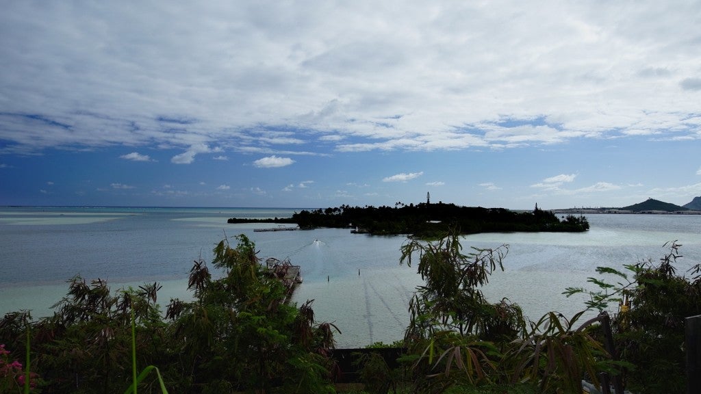
Moku O Loe, also known as Coconut Island, is CORAL’s base of operations in Hawaii. Credit: NASA/James Round
Hochberg has been working for years to bring a program like CORAL into existence. “The coral reef data we have were mostly gathered by scuba divers with measuring tapes, so they’re local, inconsistent and patchy,” he says. “CORAL will give us the first large, uniform dataset on the condition of coral reefs across key regions of the Pacific. We have good reason to be concerned about the future of reefs, but there are a lot of fundamental things we just don’t understand about them. With the CORAL dataset, we can begin to better understand how reefs interact with their environments.”
What makes this possible is a new airborne instrument called PRISM, the Portable Remote Imaging Spectrometer. Michelle Gierach of NASA’s Jet Propulsion Laboratory is the CORAL project scientist. She says, “PRISM is the heart and soul of the CORAL mission. It came into being to address the challenge of coastal observations.

Michelle Gierach, CORAL’s project scientist, at the Hawaii Institute of Marine Biology on Oahu. Credit: NASA/James Round
The abundant light on the water that makes the scientists squint creates similar problems for remote sensors trying to focus on dimly visible objects underwater. PRISM was designed specifically to handle these tough light conditions. From reflected light on the ocean, it can extract the spectral signatures of coral, sand and algae — important indicators of the condition of a reef. The PRISM instrument is able to survey entire reef ecosystems in about the same time it would take boat-based researchers to survey a few square yards or meters.
In Kaneohe Bay, the scientists pull their instrument out of the water one final time, and Hochberg points the boat back toward HIMB’s boat docks. Their agenda for today was to check the performance of the optical instruments, and they’ve collected enough data for a first test. Two other boat teams will also be checking out their instruments in the next few days. When the aircraft and PRISM arrive from the mainland, the boat teams and aircraft will make more or less simultaneous measurements on and over the bay. While that’s going on, the workers on Kaneohe Bay might actually outnumber the tourists.